Rebuilding Place in the Urban Space

"A community’s physical form, rather than its land uses, is its most intrinsic and enduring characteristic." [Katz, EPA] This blog focuses on place and placemaking and all that makes it work--historic preservation, urban design, transportation, asset-based community development, arts & cultural development, commercial district revitalization, tourism & destination development, and quality of life advocacy--along with doses of civic engagement and good governance watchdogging.

Monday, May 13, 2024

WMATA's latest bus improvement program

is discussed by WTOP, "Metro’s future of bus service could bring new routes and end some familiar stops."  

When I first saw coverage I thought, "what about the 2017" initiative, although granted it was before covid.  And when thinking about writing about it, I remembered a bus initiative back in 2006 too.  But of course, conditions have changed greatly since then.

WRT bus service improvement see:

-- "Making bus service sexy and more equitable," 2012
-- "Will buses ever be cool? Boston versus the Raleigh-Durham's GoTransit Model," 2017
-- "Route 7 BRT proposal communicates the reality that the DC area doesn't adequately conduct transportation planning at the metropolitan-scale," 2016
-- "Reviving DC area bus service: and a counterpoint to the recent Washington City Paper article," 2019

From the article:

With additional funding, Webster said the new bus network could bring 30-minute frequency for most routes, 30 new routes that would increase connections with Metrorail stations and a regionwide 24-hour bus network, which would provide overnight connections to the region’s airports.

San Francisco Bay overnight transit map.

And with that I had to laugh.  I've been suggesting that for at least 12 years.

-- "Overnight transit service," 2012
-- "Night moves: the need for more night time (and weekend) transit service, especially when the subway is closed," 2013
-- "Night and weekend transit/subway service," 2016
-- "Overnight transit service: San Francisco," 2016

The 2013 entry states that bus service should be provided to airports when Metrorail is closed.  Also see:

-- "To and from origin stations can be difficult: More on the Silver Line and intra-neighborhood transit (tertiary network)," 2022
-- "More on airport-related transit/transit for visitors," 2013
-- "To get people who have mobility choices to choose transit, they have to know it exists," 2007

The points in this entry, although ostensibly about light rail, are really about the value of a transit network, and by extension the value of the transit network as a 24 hour service.

-- "Manhattan Institute misses the point about the value of light rail transit connections to airports | Utility and the network effect: the transit network as a platform," 2020

Related is the blog entry "Branding's NOT all you need for transit" (2018) which discusses transit as a "design product"

ensuring that each and every element within the system of providing transit and mobility services is designed to be effective, efficient, successful, powerful and connected.

DC has a long way to go for that, which is why I suggest a German style "transport association" be created to integrate the services.

-- "WMATA and MWCOG announce new joint transit initiative | Could a regional "transport association" be on the horizon, or just a transit bailout?," 2024

At some point, I wrote that it would be easy to provide transit service to National Airport overnight by extending the bus service on 14th Street.  And that a late night bus network needs to include Union Station in DC as a primary node.

========================

FWIW, in the Purple Line series ("Setting the stage for the Purple Line light rail line to be an overwhelming success: Part 2 | proposed parallel improvements across the transit network," 2017), I made a bunch of recommendations wrt bus service, although I'm glad some of the improvements will happen before 2028, when the Purple Line opens.

9.  Provide integrated bus arrival and departure information screens at Metrorail, Light Rail, and MARC stations.

10.  Bus service in certain corridors between DC and Maryland should be extended and/or frequency increased to better link these areas to the new light rail service.

Many of the area's bus services terminate at the city-state line, although there are some exceptions. DC and Maryland should commit to bus service improvements in advance of the PL launch.

11.  Montgomery County bus system improvements with the launch of the Purple Line and bi-directional service on the MARC Brunswick Line should include launch of planned Bus Rapid Transit services.   

12.  Rearticulate, rebrand, and reposition-extend the Prince George's County TheBus bus transit service. Change the name of the service and the graphic design of the bus livery.

They have the same opportunity for rearticulation with their complementary local transit system. Currently, TheBus system is the least well developed of the suburban transit agencies ("By choosing coverage over frequency, Prince George’s caps what its buses can accomplish," GGW).

But they are now working on improving the system, with a Transit Transformation initiative they launched last fall.

13.  Consider a redesign and rebranding of the the metropolitan area's bus systems into an integrated framework, comparable to that of GoTransit in the Raleigh-Durham area.

This has been discussed in depth here, "Will buses ever be cool? Boston versus the Raleigh-Durham's GoTransit Model."  This gives a  deadline for launch.

From the presentation ("The Sign Design Society Event: Defining a City," designworkplan) by Ivan Bennett, Design Manger for London Buses:

One reason other systems have failed is the lack of continuity. London bus stops extend beyond central areas and cover all routes in Greater London. Ivan indicated that passengers do not just want information about where they are travelling from, but when they get there, they need the same consistently presented information. People need information near their homes and local areas, not just in the centre of the city.

15.  Set the opening of the Purple Line as the deadline for the implementation of a full-fledged integrated Night Owl bus network for the DC metropolitan area.

DSC0574719.  WMATA should upgrade its Metrorail station bus shelters.

Another aspect of the balkanized transit system in the DC area is that every jurisdiction has a different program for bus shelters--what Ivan Bennett, product design manager for the London bus program, calls "a lack of continuity."

Metrobus isn't responsible for shelters in the various jurisdictions, although WMATA does have bus shelters on the grounds of many Metrorail stations outside the core. 
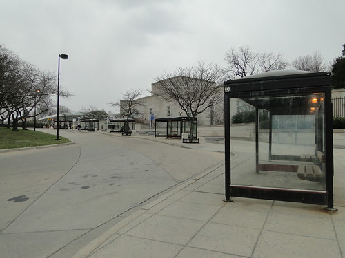
Bus shelters at the Medical Center Metrorail Station. 

Unfortunately, the Metrorail station shelters are dowdy, don't incorporate real-time arrival and departure information, could include advertising as a revenue stream, etc.

Why not use the launch date of the Purple Line as an inducement and deadline for an overhaul of the Metrorail bus shelters across the station network?

 ... although this doesn't address the fact that in an integrated bus service branding system across the jurisdictions, ideally, there would be a common set of transit shelters and amenities across the transit network.

-- Transit Waiting Environments, for the Greater Cleveland Rapid Transit Authority
-- From Here to There: A creative guide for making public transport the way to go, EMBARQ
-- Rethinking the Suburban Bus Stop, Airport Corridor Transportation Association, Pittsburgh
-- First/Last Mile Strategies Study, Utah Transit Authority

The Kansas City Streetcar Smart City "City Post" digital kiosks include a real-time tracker application for the streetcar service ("No need to wonder where streetcar is: Kiosks now offer tracker maps," Kansas City Business Journal). Photo: Andrew Grumke. 

Labels: , , , , , ,

Friday, May 10, 2024

Vision Zero initiatives on the decline: Cache County Utah shows another way

The Philadelphia Inquirer reports, "Mayor Parker’s budget slashes funding for Vision Zero, a program designed to end traffic deaths," that the mayor has cut funding for Vision Zero programs, which are designed to reduce traffic fatalities.  Other cities have had mixed to negative results from similar initiatives.

Past writings:

-- "Revisiting Vision Zero in DC and NYC," 2021

-- "A more radical approach to Vision Zero," 2019
-- "A reminder about how the entitlement of automobility is embedded into law and democratizes death by accident," 2014
-- "A "Vision Zero" agenda for DC," 2014
-- "DC and Vision Zero Revisited," 2015
-- "Updating Vision Zero approaches," 2016
-- First global benchmark for road safety in cities published by International Transport Forum," 2018
-- "Traffic safety," 2022
-- "It's a mistake to remove "Enforcement" from the "E's framework" of bicycle and pedestrian planning," 2022
-- "D.C. cuts speed limit to 20 mph to curb pedestrian deaths: a step forward but not enough | New thoughts on a comprehensive Vision Zero agenda," 2020
-- "Pedestrian fatalities and street design," 2019

To my way of thinking, it's because a lot of the crashes are due to negligence or deliberate behavior, which isn't addressable by design.

-- "The Road Not Taken | a response to a letter to the editor in the Washington Post about DC, traffic deaths and traffic safety," 2024
-- "Social marketing and aberrant driving," 2020
--  "When the car lobby encourages law breaking," 2012
-- but only recently after some high profile deaths is DC addressing this ("Reckless drivers in spotlight as D.C. hits 16-year high on traffic deaths," Washington Post

And because we don't provide actionable information and the structures to address the problem.  

For example, in a blog entry in 2016, I suggested that such information be provided at the Council District scale and that ward-focused committees address traffic safety and sustainable mobility in concerted ways.

The Cache Valley Daily reports, "Local stakeholders to host transportation safety summit at Logan Library," that the MPO there is holding a traffic safety conference next week, to support its plan to reduce crashes and deaths.  


From the article:

Cache Valley residents are being invited to attend a transportation safety summit at the Logan Library on Thursday, May 16.

That gathering is being called by safety stakeholders, including representatives of the Cache Metropolitan Planning Organization, the Utah Department of Transportation, emergency responders, Crash Data and Safety experts as well as local interest groups.

CMPO’s 2024 Safety Summit will be held from 9 to 11:30 a.m. in the Community Room of the Logan Library on May 16.  

The planning documents, Safe Streets for All Action Plan and Safety Data Analysis in particular, have a lot of great graphics communicating information in various ways about where crashes occur, demographics, etc., exactly the kind of information you need to be able to address in real terms, crash reduction.

Labels: , , , , , ,

Monday, April 29, 2024

Arbor Day: Street Trees of Seattle by Taha Ebrahimi | Trees as Cultural Landscape (at the community scale)

Arbor Day was Friday and this is Monday. I'm late.  Although many places don't necessary celebrate Arbor Day on the last Friday of April...

Street Trees of Seattle is an interesting book.  During the pandemic Ms. Ebrahimi went for long walks, began re-connecting and re-looking at the natural world, and began documenting street trees at the neighborhood scale.  

She chose to do this by drawing, and for the purposes of the book, she organized the content by neighborhood, focused on the primary type of tree "dominating" that particular neighborhood, although each section does list other significant trees that are also present.

I am fascinated by the way the book is organized because a book organized in this way could be done for most big cities, although not necessarily focusing on one type of tree within a neighborhood, as a way to help reconnect people to the "natural world" within their community.  

It's also a great way to organize walking tours, like WalkArlington's community walks or Jane's Walks the first weekend of May, exploring communities in honor of Jane Jacobs, or neighborhood history walks, etc.  

Instead of most of these kinds of tours focusing on the built environment, we can do this with trees and other elements of flora.  Obviously, arboreta do this quite a bit within their grounds, e.g., "Garden Highlights Tour" at the Morris Arboretum and Gardens at University of Pennsylvania.

Ebrahimi points out that many of our trees--especially in Seattle where 95% of the original tree cover was milled for wood soon after the founding of the city--are planted by residents--so the "natural world" is in fact not so natural, and that people bring trees from where they were before.

Images from the Ballard Neighborhood section of Street Trees of Seattle


Cherry trees in Ballard.  Photo: Joel Rogers Photography

It means that most of the trees planted in Seattle aren't native to the Pacific Northwest, which presents interesting questions, not only about appropriateness in terms of "natives," but stories about how some of these trees, like the Pacific Sequoia, thrive there, but are failing in their native habitats in response to climate change.  

Trees as place, trees as stories.  She mentioned an article in the New Yorker about apples, "Crunch: Building a Better Apple," and I was reminded of a story I read in a Toronto newspaper about an Italian immigrant who kept a fig tree going in his backyard for decades.  (If you do an Internet search it turns out Italians did this all over North America, planting fig trees as they emigrated.)

For me, I am interested in trees but more formulaically.  I think we need great tree cover in cities.  I like trees for their shade and beauty.  I like fruit trees because they help feed us.  

But from a tree leaf identification standpoint, I can identify just a few trees, maple, oak, willow oak, even though "I have been around trees forever."  I can identify more trees than that but not necessarily by leaf.

When I was a kid, my brother and I planted some maple trees from seedlings we found in our yard or others (the best one, had a "good trunk", I absconded from a neighbor's planting bed--it might have been five inches tall).  Some died and we nursed the others.

That was in the mid 1970s, and now the trees are maybe 50 feet tall--this photo is from 2018, and the trees in question are behind the garage.

But this is a "private tree" in a yard, not a "street tree" which is defined as being in the planting strip between street and sidewalk, and ostensibly is the responsibility of the local government,  

In DC, "proper tree species" are specified for each block in the city, and residents aren't supposed to plant trees in the planting strip, but they do and they aren't necessarily the authorized tree.

Trees as cultural landscape.  It is that kind of story that interests Taha.  Unlike me, she is interested in the story of the tree and its place in the landscape, who planted it and "why".  For example, one tree she learned about was planted as a barter between a family that helped a poorer one heat their house in a particularly cold winter.  The helped family planted a special tree in the neighbor's planting strip.

I realized that what she was talking about is what we might call "Trees as Cultural Landscape" at the neighborhood, district, and/or city-wide scale.  Not just the trees, or trees as objects or elements of the cultural landscape, but the stories behind them. Their historicity.  Also see "In Los Angeles, a Tree With Stories to Tell," The New York Times., which describes a community trying to save a noteworthy tree from being torn down by a developer.

The last piece in my series of articles on gaps in parks master planning is about applying the cultural landscape lens to parks planning ("Gaps in Parks Master Planning: Part Nine | Second stage planning for parks using the cultural landscape framework").  No reason to not extend this concept to street tree planning.  

Still, even though I say I have a formulaic approach to trees, this article in the Washington Post, "Everyone should have a favorite tree. Here’s mine," makes me realize that all of us probably have favorite trees.  

The maple tree is in the back of this photo.  The willow oak was already gone.

E.g., I like flowering trees like DC's crepe myrtles or the redbuds here in Utah, and we were attracted to our DC house, because of two towering trees in our backyard, a maple and a willow oak, whose canopy combined to create a kind of outdoor room that even worked well in the rain.  

Unfortunately now both trees are gone--although I did let willow oaks reseed so we'll see what happens.

Streets/street trees as linear parks.  I first heard this concept expressed by David Barth at a presentation in 2004.

North Columbus Avenue, Galion, Ohio, c. 1920s

Most cities have urban forestry units.  Most cities, at least the big cities, address street tree planning very seriously.  DC does.  And it has the nonprofit Casey Trees planting trees throughout the city, in public spaces and in conjunction with property owners and utility companies, on private property.   And the Metropolitan Washington Council of Governments just set a goal of 50% tree cover for the region ("New tree canopy goal for D.C. area calls on Arlington to get greener," Arlington Now).  

But a city or county tree plan--like the point I made about parks plans and architecture--is formulaic too.  It doesn't get into the stories of how and why of what trees are where and how they contribute to place and the stories of how they became to be planted.

Tree planting initiatives as entry points into greater community involvement.  In Utah, TreeUtah operates similarly to Casey Trees, but they tend to be more focused on planting trees in association with park systems, not just Sugar House Park for which I am on the board, but in city parks like Fairmont--in fact participating in a TreeUtah event there for Earth Day a couple years ago is how I got involved with Friends of Fairmont Park.

Separately, Wasatch Community Gardens is creating an urban orchard in Salt Lake City's westside.

Although one criticism of tree planting initiatives is that it is perhaps even more important to take care of the trees and forests we already have, a point made in today's Los Angeles Times, "Is planting trees on Arbor Day one way we can all fight climate change? Not so much."

Still, I think tree planting initiatives are an important way to get people involved, and has the potential to move them from planting to tree to advocating for forests, for their city to declare their tree cover "a community arboretum" (see below).  To get people beyond the single event of planting a tree, it has to be built into the programming--greening beyond Earth Day.

US Forest Service community involvement and educational publications. Less so now, the US Forest Service had a massive publication program, including items focused on K-12 education and adult learning.

I mention from time to time that I collect ephemera related to urban planning and what I am involved in.  

Earlier this year I acquired an amazing set of materials, developed in the 1950s, although this set was from 1960, promoting advocacy and conservation, produced by the US Forest Service.


Trees can work for the beauty and security of your neighborhood, state, and nation, 

Page 2, Page 3, Page 4

At that time, when women mostly didn't work, the Forest Service had an active communications program with women's and garden clubs that at the time were active across the country.


The NPS History website does have a collection of scans of USFS publications.  But generally not the ones before 1960, which can be pretty cool.  Some of the older ones are findable online.  A good source is the University of Pennsylvania, such as for Forestry Activities: A guide for youth group leaders.

Community/municipal arboreta.  Perhaps the largest city participating as a "community/municipal arboretum" is Newport, Rhode Island ("As city’s first generation of exotic trees die out, Newport Tree Conservancy works to replace them," Newport Daily News).  The program is run by the ArbNet accreditation program, sponsored by Morton Arboretum in Illinois.

Yalecrest, Salt Lake City.

I think more cities should do this as a way to set higher expectations and standards in how they address their tree cover.  Apparently, Bexley, Ohio was the first ("Bexley could be first U.S. city to be declared arboretum," Columbus Dispatch).  A municipal arboretum only includes trees in public spaces.

What about accredited neighborhood arboreta?  I also think it would be neat for neighborhoods, especially in big cities, to consider getting designated as a "neighborhood arboretum," because it is less likely to happen at the scale of the whole city.  

This came up when I was on a walking tour In Salt Lake's  Yalecrest neighborhood a couple years ago.  The guy was talking about the tree cover and he said "you know, we live in a forest,. "  And I started talking to him about the already designated a historic district, would be a great candidate.  

Unlike a community arboretum, depending on the interest of property owners, a neighborhood arboretum could include both public and private trees.

An idea to expand tree identification markers in arboreta.  Street Trees of Seattle has a nice set of references.  But something I haven't seen before is a separate set of references by tree.

It would be neat to include those kinds of references in a QR code as part of the signage markers for individual trees.

Conclusion: Street Trees of Seattle.  For me the key concepts are:
  • a great book if you live in Seattle, a great way to learn about the city and its neighborhoods in a new way
  • the concept of the cultural landscape -- a (tree and trees) not just as an object, but an element of place, with historicity--a story to tell
  • Fascinating way to organize the content by neighborhood
  • as a book its extendable to other cities, especially organized by neighborhood
  • the neighborhood focus is a good way to organize tours to better expose people to flora in the "natural world" of their communities
  • organizing references by tree is a step forward too, and could be incorporated by arboreta into tree identification markers through QR codes

Labels: , , , ,

Saturday, April 27, 2024

I wonder if Mayor Fenty hadn't dissolved the Anacostia Waterfront Initiative in 2007, merging it into another city agency, if development would have happened faster?

Anacostia in better days.

The Washington Post reports on a press conference in Anacostia, the most economically lagging area in DC, where the Mayor discussed improvements in the area, in association with a new building for the Department of Housing and Community Development, which was already there, in a not so old building ("After decades of disinvestment, D.C.’s Anacostia welcomes new developments").

Did Fenty's dissolution of a focused Anacostia community development corporation, the Anacostia Waterfront Initiative ("Bill targets Anacostia Corp.," Roll Call) lead to more than a decade of delays in improvements there?

In some ways yes--there would have been a focused initiative.  In some ways no--because developers won't really go to Anacostia until most of the best opportunities have been "used up" elsewhere in the city.

Notably, most of the newest developments are city properties--the new DCHD building and a building for the Department of Health.  The businesses described as opening have social and justice motivations, not so much business-based ones.

The reality is that government buildings don't generate a lot of spillover business development, as I discussed in another entry.  And from an efficiency standpoint they should be more centrally located (see Central Place Theory).  From the previous entry:

Reunion Square will will include the city's new Department of Health headquarters, a 120-room hotel, a 132-unit affordable senior building, another 481 residential units, a new home for the Anacostia Playhouse, and 140,000 square feet of retail.  Note that 140,000 sf. of retail space is insane.

Office development/limited multiplier effect.  The Post reports, "DC Health moves to Anacostia with high hopes for community impact," about a new revitalization effort by the city, bringing the Department of Health and its 600 employees to Anacostia.  From the article:

Administration officials see the influx of workers as an economic boost and part of a broader effort to scale up critical health infrastructure in a place where life expectancy and health outcomes lag behind neighborhoods to the west. While the department doesn’t provide direct medical services on-site, DC Health does focus on making federal dollars work for city residents, funding nonprofits and community groups working with people who need public health resources.

... The city is paying about $1 million per month to lease space in the 250,000 square feet building owned by Four Points, LLC, according to the Department of General Services. The city will continue to pay $1.46 million per month at North Capitol Street, which will be renovated to make space for other D.C. government offices, DGS said. 

The parts of the building open to the public are on the ground floor where Vital Records and Licensing office staff will help with birth and death certificates and licenses for health professionals including nurses, pharmacists and dentists, and barber and beauty shops, although most of those tasks can be completed online. 

Note these are two very different issues, health outcomes and revitalization.  And as far as health outcomes go, I outlined a brilliant approach ("Ordinary versus Extraordinary Planning around the rebuilding of the United Medical Center in Southeast Washington DC | Part One: Rearticulating the system of health and wellness care East of the River," 2018) that the city ignored.

I've written about relocation of DC government agencies over the years as a misguided economic development strategy ("The Reeves Center Myth Revisited," 2011, "Office Buildings Won't Save Anacostia," 2005).  It's not that the idea is bad per se, just from a numbers standpoint it doesn't have much effect, and comes at the expense of transit efficiency.  Especially in secondary and tertiary business districts.

First, office workers don't support much retail.  The old rule of thumb was1.5 sf. per person on convenience goods (think CVS) and 3.5 sf. per person on quick service food (sandwich shops, etc.).  So 600 workers = 3,000 sf., of retail support which is a couple storefronts.  

Second, work from home further minimizes the impact  Third, so does e-commerce.  It's hard now to seed retail around office development because of this.  

Third, while I haven't seen studies on DC government workers per se, a definitive study on federal workers in the L'Enfant Plaza area found about 65% of workers brought their lunch--which is why the food options there are so paltry.

In short, not a solution.

WRT the larger number of total retail space in the Reunion Square project, again old, not taking into effect e commerce effects--so many companies now are shutting stores, is that the average resident supports 7.5 sf. of retail.  You need at least 20,000 residents with decent incomes to support that amount of retail.  Still, Reunion Square looks like an important addition to the community and its rebuilding efforts.

I have written a lot about ways to accelerate improvement "East of the River":

-- "Revisiting the 11th Street Bridge Park project as an opportunity rather than a folly: a new revitalization agenda for East of the River, DC," 2024
-- "Capital One Arena, Wizards and Capitals may move to Alexandria | Why not the RFK campus?," 2023
-- "DC's 11th Street Bridge Park project," 2022
-- "The Anacostia River and considering the bridges as a unit and as a premier element of public art and civic architecture," 2014
-- "DC has a big "Garden Festival" opportunity in the Anacostia River," 2014
-- "A world class water/environmental education center at Poplar Point as another opportunity for Anacostia River programming (+ move the Anacostia Community Museum next door)," 2014
-- "Saving the South Capitol Bridge as an exclusive pedestrian and and bicycle bridge," 2014
 -- "Wanted: A comprehensive plan for the "Anacostia River East" corridor," 2012

Labels: , , , , , ,

Esso gasoline station road map, Tennessee and Kentucky, 1956, showing the Lookout Mountain Incline Railway funicular in Chattanooga on the cover

 I am always intrigued by the very rare occurrence of gasoline station roadmaps that show "transit."  

I have Esso maps with a map of the London Underground, at least two New York City maps (Esso, Texaco) showing the Manhattan part of the NYC Subway, this map, an Exxon Map showing public transportation of the United States, along with highways, and and British American Oil map of Toronto with a small drawing of a TTC subway entrance.  There is an Esso map for Alberta that I haven't acquired yet showing a cable car for skiing related transportation, as part of the set of drawings on the cover.

An inset on the inside of the map reads:

The front cover of this map shows one of the cars of the Incline Railway ascending to the summit of historic Lookout Mountain, Chattanooga, Tenn.  Through wide windows and glass roofs, passengers gain startling views of the city and the Moccasin Bend of the Tennessee River.  Equipped with numerous safety devices, the cars are hauled by cable simultaneously in opposite directions, passing at a midway station.  The Incline Railway operates daily, 6am to midnight.  One way fare is 35 cents, round trip 65 cents. 

This is also cool because it includes an inset on the Great Smoky Mountains National Park and a map of the TVA lakes/recreational facilities.   Interestingly, it's produced by Standard Oil of New Jersey (Esso), separate from Standard Oil of Kentucky--later acquired by Standard Oil of California (Chevron)--which produced its own maps too.

These kinds of maps date to what Peter Muller calls the "Recreational Auto Era" of urban form, when people stayed pretty close to home, but when they drove distances it was generally for tourism or to visit friends and relatives.  

Interstate Highway and US Highway road signs, Greensboro, NC.

This era was from 1921 to the 1950s.  During the RAE people drove on state roads and federal highways (the US roads).  Interstate Freeways didn't exist then, and when they started being constructed is when urban form shifted from a focus on the center city to the metropolitan area, knitted together by freeways.

The maps reflect this desire in a couple ways.  First, back then most of the large chains had touring services that would provide travel and route information.  Those services ended in the early 1980s.  Two gasoline price crises in the 1970s led to changes in the gasoline sales business model.  

They shifted to selling gas as a fungible commodity and were no longer so focused on developing "the brand" and working to have loyal customers focused on the brand.

Second, RAE maps usually include inserts and drawings of places worth visiting, like the Smoky Mountain inset.  Third, although it varied, some firms showed local scenes on the cover of the map, from the states the map covers.  But sometimes they alternated this and definitely later as the US moved into the "Metropolitan City" era, cover art focused on branding of the chain, not local landmarks.

One map I haven't yet acquired from the Esso Kentucky/Tennessee maps shows an Atomic Energy Museum on the cover, sponsored by the Tennessee Valley Authority, which produced electricity from dams and nuclear power plants.  Also, a key facility for the production of nuclear weapons in WWII was in Kingsport, Tennessee.

Labels: ,

Wednesday, April 24, 2024

Gaps in Parks Master Planning: Part Nine | Second stage planning for parks using the cultural landscape framework

 Gaps in park master planning frameworks

-- "Gaps in Parks Master Planning: Part One | Levels of Service"
-- "Gaps in Parks Master Planning: Part Two | Utilizing Academic Research as Guidance"
-- "Gaps in Parks Master Planning: Part Three | Planning for Climate Change/Environment"
-- "Gaps in Parks Master Planning: Part Four | Planning for Seasonality and Activation"
-- "Gaps in Parks Master Planning: Part Five | Planning for Public Art as an element of park facilities"
-- "Gaps in Parks Master Planning, Part Six | Art(s) in the Park(s) as a comprehensive program "
-- "Gaps in Parks Master Planning: Part Seven | Park Architectural (and Landscape Design) History
-- "Gaps in Parks Master Planning: Part Eight | Civic Engagement"
-- "Gaps in Parks Master Planning: Part Nine | Second stage planning for parks using the cultural landscape framework

Planning a park at the outset is about creating the landscape design and program.  Planning parks at the outset is "simple" in that land features are identified and either preserved or enhanced, and a program--who the park will serve and how it will be done through the provision of a set of facilities including landscape elements--will be created.

Plans cover land and water features, facilities, intended uses, and programming.  At the end of the process one of the ways the plan for the park gets expressed is through a map schematic.  While detailed, they are examples of more simplified planning documents.

Burgess Park, Southwark, London.  Note the level of detail specified on the schematic.

Updating the park master plan.  The planning issue comes up when you update a plan for a park.  How large is the park, what features does it have, is it cultural and historically significant or are there elements that deserve more detailed analysis, etc.  

Sugar House Park is almost 70 years old, and has different planning needs compared to when the park was created.  Items like vegetation and Parley's Creek were not covered thoroughly in the most recent (2008) master plan update process.  And there are more issues today like climate change and its effect on the park and patrons, and how to respond.   


Many of the "natural features" in Sugar House Park are specified in the post on climate change, "Gaps in Parks Master Planning: Part Three | Planning for Climate Change." including Parley's Creek, its watershed, and flood control, water conservation, turf and plants, trees/arboretum, and fauna.  Topography and viewsheds are key elements also.

When the park experienced flooding via Parley's Creek in 2023.

Mobility, heat effects  and mitigation measures, park and park architectural history, buildings and structures and other facilities, programming, strategy and management of the park are the other necessary elements to have a plan that is truly comprehensive.

So a park or park system plan, to be comprehensive should be a combination of a cultural landscape plan, a regular park design and program plan, a capital improvements plan, an organization and management plan, a branding and marketing plan if the park is signature, a programming plan, and a fundraising plan.  

Or would you call those "natural elements" environmental, and call that section of a plan an environmental master plan?  Environmental plans have five elements: land, air, water, waste, and energy, some of which you would address only parenthetically in a park plan.

Definitely complicated depending on the nature of the particular park or park system being studied.  Because there are so many items, you can call it a cultural landscape plan because that approach is so macro focused and comprehensive.  

But maybe the issue is to just make the comprehensive park or park system plan more comprehensive, by including as many of these other items as possible for study, but not calling it a cultural landscape plan per se.

Cultural landscape planning approach.  A way to tie together the various planning threads for a park and/or a park system is to use the cultural landscape planning approach, which looks at sites more comprehensively than a typical parks plan.

I think that it is in next stage planning where the cultural landscape approach becomes more relevant to parks planning.  For Sugar House Park, the elements to address in more depth would be related to the land, water, vegetation, buildings and history.  

Cultural Landscapes

A cultural landscape is a place with many layers of history that evolves through design and use over time. A cultural landscape embodies the associations and uses that evoke a sense of history for a specific place. 

Physical features of cultural landscapes can include trees, buildings, pathways, site furnishings, water bodies – basically any element that expresses cultural values and the history of a site. 

Cultural landscapes also include intangible elements such as land uses and associations of people that influenced the development of a landscape. Cultural landscapes include neighborhoods, parks and open spaces, farms and ranches, sacred places, etc.

However, the cultural landscape approach is usually applied at a large scale.  In the US, it's used most often for creating management plans for National and State Heritage Areas, which can cover hundreds of square miles and hundreds of separately owned cultural resources.  

ATHA visitor center in Hyattsville, Maryland.

Maryland has a National Heritage Area in Baltimore and a program that designates state heritage areas.  

Planning occurs at two scales, for the heritage area as a whole (ATHA management plan), focused on the big picture and identifying historic themes, and plans for individual sites like house museums, parks, etc.  

The plans for individual units range from park or museum master plans, to house museum plans (building preservation, marketing, etc.). 

-- Guidelines for the Treatment of Cultural Landscapes, The Secretary of the Interior’s Standards for the Treatment of Historic Properties
-- Protecting Cultural Landscapes: Planning, Treatment and Management of Historic Landscapes: Planning, Treatment and Management of Historic Landscapes, Preservation Brief 36
-- How to Evaluate and Nominate Designed Historic Landscapes, National Register Bulletin 18
-- Guide to Cultural Landscape Reports: Contents, Process and Techniques

-- The Alliance for Historic Landscape Preservation
-- The Cultural Landscape Foundation

The most distinctive element about large scale cultural landscape planning is that interpretation is organized around the major historic themes of the area (comparable to identifying the period of cultural significance for a historic district, "What is the Period of Significance and what does it mean for Cleveland Park?," Cleveland Park Historical Society).  So the Rivers of Steel Heritage Area in Pittsburgh didn't include one particular mining area as a resource, because it was associated with the steel industry of Cleveland.

One Maryland State Heritage area is the Anacostia Trails Heritage Area in Prince George's County, abutting DC.  The state areas focus on highlighting local historic assets and marketing them as a tourism product.  

The marketing program may include visitor centers, the organization of cultural resources into "trails," events, wayfinding and interpretive signage, brochures and other elements. 

Parks and park systems are simpler units than heritage areas and a modified approach to planning at the scale of the cultural landscape makes more sense. Obviously not all parks and local parks system are the same.  And only some parks probably rise to the level of high historic/cultural significance.

The challenge is to do more comprehensive planning for the parks that should be planned at that level of detail. I argue a more simplified approach to cultural landscape planning can be adopted for master planning for local parks systems and individual parks.  Using the principles, not the level of detail.  

Broad Branch Park in New Jersey is a rare example of a local park with a cultural landscape plan, which took several years to create.  The report has six volumes and totals over 1,000 pages.

  • Existing conditions
  • History of the park and critical periods of development
  • Hydrology, infrastructure, and historic fabric
  • Structures in the park
  • Vegetation in the park
  • Treatment and management

Such detailed planning for an individual park is beyond the capacity of most parks systems.  Note that many parks conduct Cultural Landscape studies using the methods of the National Register of Historic Places.  

For example, the Cultural Landscape report (vol. 1, vol. 2) for the Eleanor Roosevelt Historic Site in Hyde Park, New York makes a number of treatment recommendations:

  • Improve Landscape Condition
  • Protect and Enhance Historic Setting
  • Reestablish Historic Field and Forest Patterns
  • Perpetuate Historic Managed Vegetation
  • Enhance Historic Character of Roads and Walks
  • Provide Effective Deer Control
  • Maintain Compatible Park Furnishings
  • Expand Landscape Interpretation

The 1983 Plan to restore and revive Central Park in Manhattan is a great example of this kind of plan for a more local, but significantly historic resource. 40 years later the book still reads so well, and offers a lot of guidance for contemporary parks planning.

-- Rebuilding Central Park: A Management and Restoration Plan

Again, such reports are focused on identification and maintenance of historic resources, while for a contemporary park or park system, only some elements may be historic, but application of the analytical  framework of cultural landscape planning is relevant.  

The challenge is identifying certain resources as historic and recognizing this and treating them appropriately, while mixing in other planning approaches to other elements of park resources.

A good way to contrast first stage versus second stage parks planning would be the Rebuilding Central Park plan of 1983, to revive a park constructed starting in the 1850s, or the Bryant Park program, versus the creation of the High Line in Manhattan, Brooklyn Bridge Park in Brooklyn. or Millennium Park (2009 Rudy BRuner Award: Silver Medal winner) in Chicago.

This came up with Sugar House Park and planning for replacement pavilions.  I argued the approach was a-historic and failed to acknowledge the relevance of the architectural history of park buildings and structures to the decision making process ("Gaps in Parks Master Planning: Part Seven | Park Architectural History and Design").

For Sugar House Park, the elements relevant to a cultural landscape second stage planning approach would be: 

  • site history (former prison)
  • architectural history of the park (some materials from the prison are used in some structures that exist today) and area
  • as well as park architectural history more generally (parkitecture style)
  • viewsheds towards the Wasatch Front Mountains
  • Parley's Creek (natural) and the pond (man-made)
  • topography, in particular the hills (my line is that hills are a competitive advantage for the park compared to other parks in Salt Lake City, which are mostly flat--two areas are especially popular for sledding) 
  • tree cover and management (treating the trees collectively as an arboretum--we are in the process of getting Level One accreditation from ArbNet, and will continue to develop this concept over the years) 
Adding the cultural landscape lens to parks planning.  In parks master planning updates, agencies should endeavor to identify important historic and cultural elements for each park, although just thinking about Salt Lake County and Salt Lake City parks, most parks do not rise to this level.  

For signature parks, it shouldn't be hard to identify the elements that for future planning purposes, qualify as significant and relevant to cultural landscape approaches to planning.  

Does that mean a cultural landscape study should be conducted for each park that qualifies?  That's hard to say.  Many parks departments don't have that kind of infrastructure and funding, although they could work with local historic preservation offices to secure some. 

Maybe doing the equivalent of a "windshield survey"--a term from historic preservation where you do a quick visual assessment of a property to determine if it is a significant or contributing resource to a potential historic district--is enough (Bulletin 24: Guidelines for Local Surveys, NRHP), provided that the identified elements get the additional attention deserved within the planning process.

Salt Lake City.  To its credit, the Salt Lake City Public Lands Department (broader than "just" parks) has done an assessment of parks in terms of their cultural and historic resources (memo).  Five parks were designated as particularly significant and a cultural landscape study has been completed for Liberty Park (created 1881), while studies are underway for Pioneer Park (dating to 1847 as a public facility)--the signature Downtown park, and Allen Park (which for quirky reasons is culturally significant, dating to the 1940s).  The intent is to produce such studies for 11 parks in total.  But funding hasn't been secured.

I can't claim to have read hundreds of parks master plans, but this kind of identification of particular parks with significant historic and cultural resources is unusual.  

On the other hand, the language of the memo as submitted to the city's Historic Landmarks Commission hasn't made it into the city's most recently updated parks plan, ReImagine Nature, although this plan is more of a vision framework than a master plan.

Salt Lake County.  I am not so familiar with the Salt Lake County system, but most of the parks were created after 1960, and most don't have historic elements.  

Although, some parks in some communities across the county may date to the 1800s (that's when the area was settled by Caucasians) and early 1900s, and often have elements relevant to historic and cultural preservation.

The best way to ensure that cultural and historic resources are considered within parks master planning is to take the Salt Lake City approach and do a broad survey of park resources, and determine which parks require differentiated treatment when it comes to further planning and updated plans for specific parks. 

Labels: , , , , , ,

Tuesday, April 23, 2024

Campus activism: potential blowback on the Republicans?

I started college in the late 1970s.  Since "the 1960s" were really from about 1964-1974, there was still a lot of recognition of that period in Ann Arbor.  

As is my want, when I was in college I became interested in how colleges work and I read a lot of the literature of the time about "college student development" especially William Perry's Forms of Intellectual and Ethical Development in the College Years: A Scheme (book, a webpage).  Others writing along these lines included Lawrence Kohlberg and Carol Gilligan.

Plus I read works like Kirkpatrick Sale's SDS and Todd Gitlin's The Whole World is Watching about "the movement."  Me and some others even brought Gitlin to campus to speak.

Perry discusses how students start at the dualism point--yes or no--move to an everything's relative position, and then, ideally, to what he called "commitment in relativism" in that you use relativistic thinking to come to a position.

Probably most university presidents aren't familiar with this literature, because I was shocked when the Penn, Harvard, and MIT presidents were grilled before Congress last November about pro-Palestinian activism on their campuses, which was pitched as anti-Semitism, that the presidents didn't reference this work ("Lawmakers question Harvard, Penn and MIT presidents on antisemitism," "The anti-college subtext to the right-wing response to Gaza protests," Washington Post). Two of the presidents ended up resigning.

Interestingly, now that I think about it, from Perry's perspective, Republicans in Congress reason dualistically, which isn't particularly sophisticated.

Roger Martin, former dean of the Rothman School of Business at the University of Toronto has a related concept called integrative thinking where people simultaneously consider multiple ideas that conflict and come up with a way to resolve them. 

In any case, you can be pro-Jew/pro-Israel, which I am, because my father was Jewish, and I remember books in our house about the Arab-Israel conflict, while recognizing at the same time that the Palestinians have a co-equal right to live, and the way that Israel treats the Palestinians is abominable.  

Sure Hamas was terrible and should be condemned, but Hamas, in effect, was created (blowback) by Israel's treatment of Palestinians.  And you can be against killing of all sorts.  I think Hamas was wrong.  And so is Israel, which has killed over 30,000 people in its war in the Gaza Strip.

I do think universities have the obligation to better integrate understanding college student development and working with students to move along the ladder of cognitive and ethical development.  Obviously that's not happening in a purposeful way in most universities, even "the best" ones.

The Columbia University president came up before Congress last week and she completely capitulated, and later asked the NYPD to remove a protest sit in student camp out staking a pro-Palestinian position ("Columbia Students Arrested Over Campus Rally May Face Other Consequences," New York Times).  

And USC told the Palestinian valedictorian that she wouldn't be able to give the traditional speech at commencement ("USC got it wrong in canceling valedictorian’s speech. Here’s what the school should do now," Los Angeles Times).  

Police officers stand near tents erected by pro-Palestinian protesters on the South Lawn at Columbia University in New York, on Thursday. C.S. MUNCY/The New York Times/Redux

Last week students were removed from an encampment at in California.

FWIW, I participated in a sit in back in the day about disinvesting from South Africa.  I'm sure the administration was indulging us, but they didn't call the police on us even though we remained in the Regents board room overnight.  

Contrast that to now sadly, as UM is considering much harsher policies ("Some concerned University of Michigan proposed policy on protests could quell free speech efforts," CBS).

I don't think students are wrong to support Palestinians.  Wrong is violence against Jews or destruction of property.  Reporting by the student newspaper at Columbia found that most of the incidents were off-campus by people not related to the university ("Rabbi advises Jewish students to ‘return home as soon as possible’ following reports of ‘extreme antisemitism’ on and around campus," Columbia Spectator).

In response to the Columbia action, students at Yale and others created tent camps supporting Columbia students and the Palestinian cause ("Students at more universities announce solidarity rallies after 108 pro-Palestinian activists are arrested at Columbia," CNN, "UM students set up encampment on Diag protesting war in Gaza," Michigan Public Radio).

Photo: A.J. Jones, Michigan Public Radio.

I wonder if this will wildcat across the country, the same way demonstrations did after students were killed at Kent State (and Jackson State) in 1970 when they were protesting against the Vietnam War  ("It began with defiance at Columbia. Now students nationwide are upping their Gaza war protests," AP).

There are protests at University of Washington today ("Student walkout: Updates as WA students protest Israel-Hamas war," Seattle Times).

However, protest has become much less effective in changing society over the years.  I don't know why exactly.  Some argue it's co-opted by elites and there's definitely truth to that.  And corporate interests are much more organized and active in protecting their interests ("The small business tyrant has a favorite political party," New York Times), "The UAW’s Chattanooga Victory: Score One for the North in Our Endless Civil War," American Prospect).

-- "How violent protest can backfire," Stanford News
-- "The end of protesting," Comment
-- "Can protests lead to meaningful changes in government policy, particularly around economic redistribution?," Brookings
-- "Do Protests Even Work," The Atlantic

Some is because back in the day there were just a few communications sources and they had disproportionate power and authority and most people read or watched them.  

But with cable television and social media and the decline of newspapers and traditional television news, effect can be dissipated, even though social media had some success wrt both Tahrir Square in Cairo and Chiapas state in Mexico.  Not to mention the development of a fabulist conservative media ecosystem.

Still, the Republican/conservative response to the Israel-Palestinian issue may in fact spark a new activism. And revive the strength of protest movements.

Although the conservatives have some advantage in that the winter term is almost over, and students would tend to go back home for the summer.

=====

FWIW, a lot of my peers at the time thought that activism in the 1960s had failed.  I used to respond, "the US got out of Vietnam, what do you mean?"  But definitely after the US took out the troops, the big reason or impetus for activism faded.  But at least when I was at school there were two more waves, Divestment from South Africa and then US involvement in Central America, specifically El Salvador.

Labels: , ,